GPSLog Labs Blog

GPSLog Labs Blog

New features and tips for using gpsloglabs.com

Filed under

routes

Updates for August 25th

Yet another long gap between posts, but there have been lots of updates to GPSLog Labs in the interim. Here's a brief summary:

  • Keyboard shortcuts

    • f View fullscreen maps/graphs
    • q Open quickfind
    • escape Close full screen map/graphs and quickfind popup

    The keyboard shortcuts make all these features much more useful as they're only a keypress away.

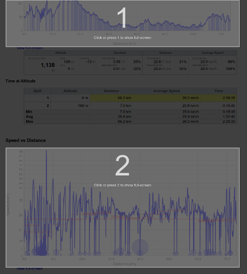
    A neat feature is if there is more than one possible graph/map to view in fullscreen, an overlay is added and you can press a number to select the one you're after.

  • Tag, place and route lifetimes

    A new visualisation attempts to indicate which tags, places and routes are still in use and those that are "retired".

    This information is also used to hide suggestions for tags and places you are probably no longer using and gray out the retired tags from the add tag popup and quick find popup.

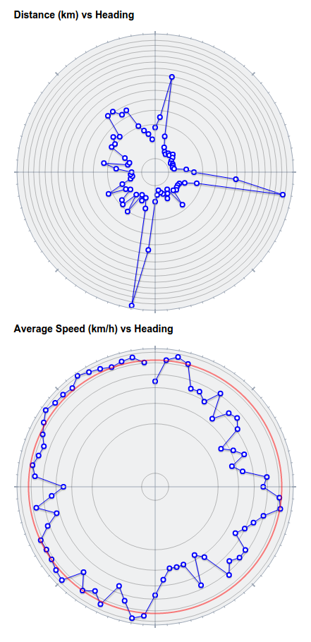
  • Distance and speed vs heading graphs

    These graphs have been made prettier and easier to read with the graph now rendered as a circle with ticks for the compass points.

  • I've added axis labels to all the graphs, which will make all the grade 6 maths teachers out there happy, as well as making the graphs much easier to understand.

  • The goal, route and split detail trend graphs tabs have speed and heart rate histograms on them too now, which helps spot the trends better at a glance.

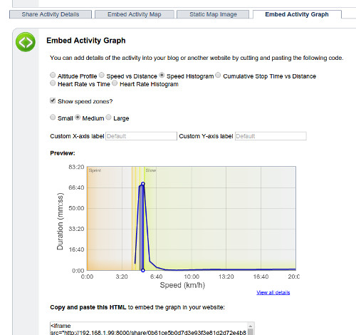
  • The embedded graphs you can share on your own sites now support speed and heart rate zones backgrounds as options, and also let you specify the text for the axis labels.

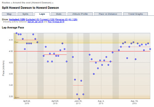
  • Laps graph

    There's a new Laps tab on route split detail page that compares performance across sessions on activities with multiple laps, e.g. hill intervals or laps around an oval.
Filed under  //  changelog   tags   keyboard   graphs   sharing   embedding   routes   checkpoints  

Merging Routes

Routes have always been between two different places. If you wanted to compare activity along similar routes between nearby places, you had to create checkpoints to generate splits along the common sections.

I've now changed it so that a route can start and stop at one or more places.

This is particularly useful if you have a commute and have moved house or jobs. It works best if the places are still fairly close together. If they're not, then the altitude profiles, distances etc. are not likely to be as useful, but it depends on what you are trying to compare.

There are two ways to create these new routes:

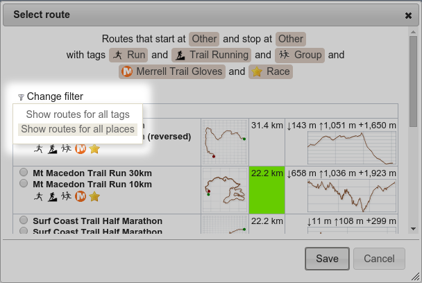
  1. When selecting a route, choose Show routes for all places from the Change filter dropdown.
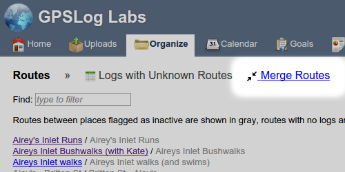
  2. If you have had to create multiple routes already and now you want to combine them, you can select Merge Routes from the Routes page:
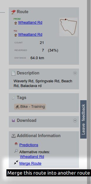
    Or from the bottom of Route detail page:

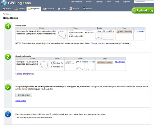
That will open the Merge Routes page which allows you to select the two routes you want to merge.

This will combine the activities and stats for the two routes.

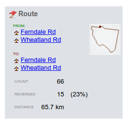
The new route detail page will list all the start and end places:

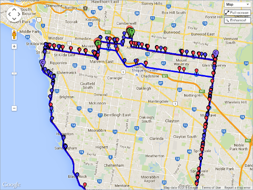
Markers for all the from/to places will be shown on the map:

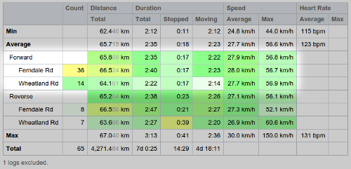
Route stats will be broken down by the pairs of start/stop places used by the activity:

Best effort comparisons will be available for the matching start/stop places and also all the activity in the Route:

Should you need to reverse this process, you'll need to recreate the second route and select it for all the activity it applies to.

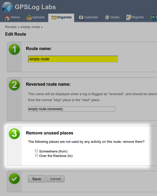
Once a start/stop place is no longer used on a route, you can remove it from the edit route page:

Filed under  //  routes  

Updates for May 25th

As noted earlier, now that GPSLog Labs has been migrated to the new server and updated to newer library versions, there has finally been some time to add new features:

  • Sharing Routes between multiple places.

    See the next post on Merging Routes for details.

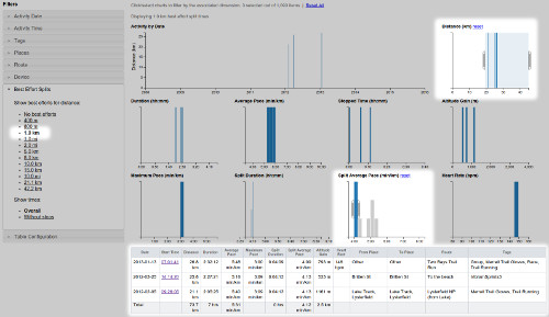
  • View best efforts in crossfilter.

    Tag crossfilters have got a bit more powerful and can now include best effort times.

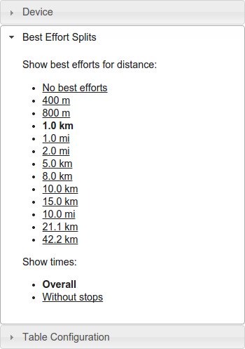
    For example, to answer questions such as "what's the fastest I've run 1km when doing long runs?", select the distance from the Best Efforts Splits filter:

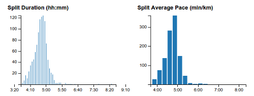
    This will add Split Duration and Split Average Speed/Pace graphs to the dashboard and table:

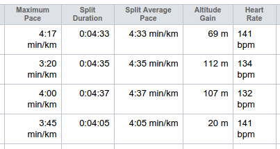
    You can filter using the charts to select just "long" runs and "fast" best efforts:

  • Suggested edits.

    This one is a little experimental and I'll be refining it I'm sure. The idea is that GPSLog Labs will remember the edits you make to your uploaded activity (fixing unmatched places, assigning routes and tags) and speed up the editing process the next time by providing suggestions where it can.

    When GPSLog Labs can provide a suggested edit, a button will be displayed next to the activity:

    Selecting an option from the suggested edits will apply updates to the tags, route and start/stop places as necessary.

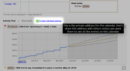
  • Activity feed projections iCal feed.

    The Activity Feed on the home page displays dates you're projected to hit various milestones (distances, counts and goals) but it's pretty easy to overlook something interesting that's coming up.

    Now there's an iCal feed url you can add into your calendar to see these projections on your phone or somewhere else convenient so you can get a little kick of motivation when you're about to pass the milestone.

Filed under  //  changelog   routes   bestefforts   editing   crossfilter   activityfeed   icalendar  

Updates for December 17th

Some recent updates to GPSLog Labs, just in time for Christmas:

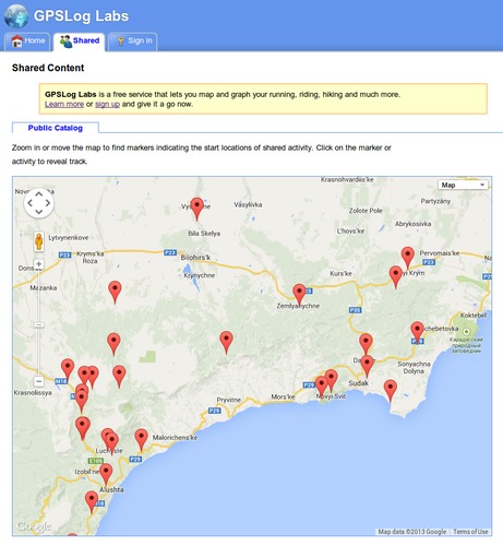
  • GPSLog Labs now has a public catalog of shared logs.

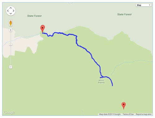
    By zooming in on a region of the world map, you can see activity other users have shared and use it to plan your runs, rides and hikes.

    You can still choose to keep your activity entirely private, or share it with a specific group of people, but if you want to include your activity in the catalog, simply go to your shared content, edit the activity you wish to share, and tick the "Include in Public Catalog" checkbox.

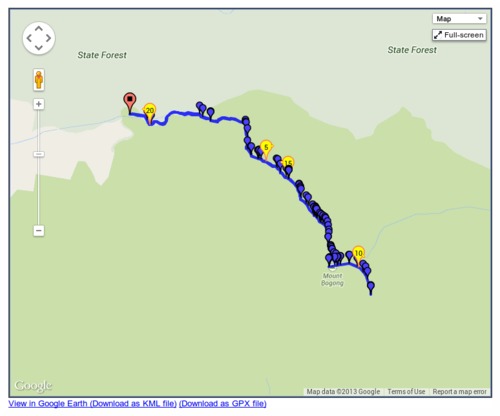
  • You can also now download shared activity as a GPX file which can then be loaded onto your device for navigation when you're out and about.

  • The route detail, route split detail and selection detail pages are now using a layout with a panel on the right hand side to better use the space on wider screens.

  • Editing notes in the side panels now saves your changes without reloading the page.
  • Also, I fixed a bunch of issues unfortunately introduced by the new dynamically loaded tabs. Apologies if you noticed things that weren't working properly for a while, and if you have any other issues, please let me know.
Filed under  //  changelog   routes   sharing  

Updates for November 10th

Some recent updates to GPSLog Labs:

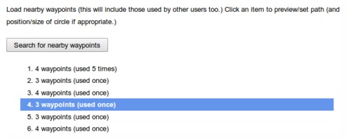
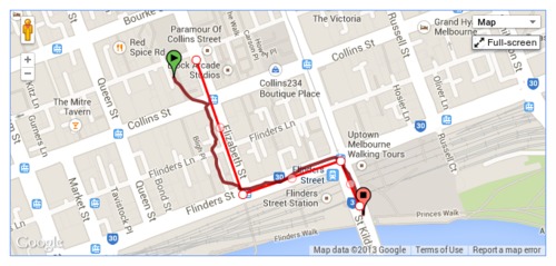
  • When filtering a log file using a time or position filter, you can now copy nearby waypoints, rather than drawing the line each time.

    Once you zoom into/select the area to be filtered, click the "Search for nearby waypoints" button.

    This will list all the nearby waypoints and you can click on them to copy them into your filter.

    This search uses not only waypoints you've created before, but also those created by all the other GPSLog Labs users, so you can take advantage of paths others have marked and save yourself some effort.

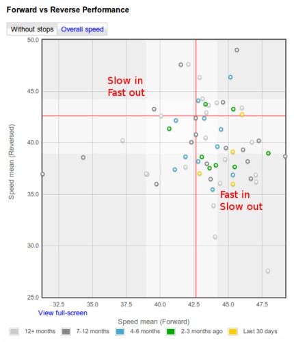
  • New forward vs reverse performance chart for routes.

    This graph compares the forward speed with the reverse speed for any days where you go in both directions on the route. E.g. a commute to and from work.

    The shading on the graph represents the 25th—75th percentile of the data, the red line indicates the median speed.

    Points in the bottom-right represent fast forward direction with a slow log in the reverse direction, while the points in the top-left are slow forward and fast reverse. (Note, this description is flipped for pace formats.)

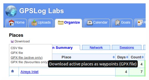
  • Download places as waypoints in a GPX file that you can load into your GPS to assist with navigation and route planning.

    The Places page has a new "Download" menu that lets you generate a GPX file containing waypoints for each of the places you have created.

    You can choose to get all your places, just the active places or just your favourites.

    This menu also incorporates the CSV download option which will get all your place information into a spreadsheet.

  • Downloaded zip files now have modified dates of the files set to the current date/time.

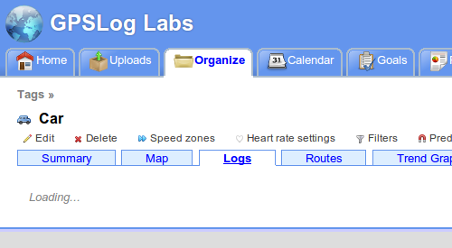
  • The tabs on various pages around the site now load dynamically, so you'll notice a little "Loading..." message after the tab is clicked. You can then quickly switch between the tabs without waiting for the whole page to load again. This is very handy when comparing the heart rate graph with the altitude profile or speed graphs, for example.

  • And lastly, a little tip:

    Set a place radius to 1m to prevent it being used to cut activity without having to mark it as inactive. This will still allow you to select the place as a start/end point manually.

    This can be handy if you pass by a place on a regular commute and don't want to have to remove the stop from your processed activity.

Filed under  //  changelog   routes   filters   position filter   time filter   places   waypoints   tips  

Updates for September 7th

Some recent updates to GPSLog Labs:

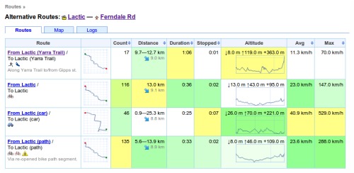
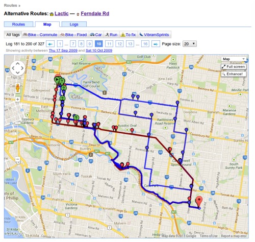
  • New Alternative Routes page.

    This page lets you easily see all logs between two places, you can access it by clicking the "Alternative routes" menu option on one of the routes between the places you're interested in.

    It provides a summary of all routes between the two places:

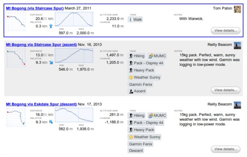
    And most usefully, it lets you see all activity in a comparison table or on a map, filtering to just one tag if you like:

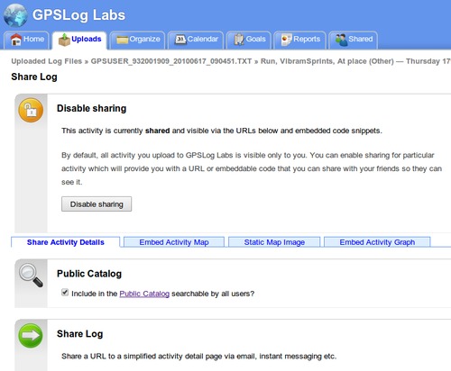
  • The Share Activity page was getting a bit long, so I've split it into tabs:

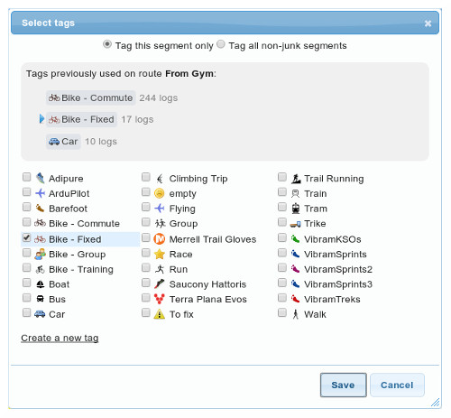
  • The session detail page has been updated with a better tag dialog and a layout that provides clearer indication of the activity that makes up the commute to and from the place and any activity at the place.

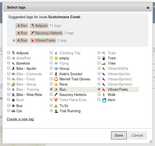
  • The Select tags dialog layout has been updated to show the list of tags in columns and selected tags are highlighted better now too, making it easier to use.

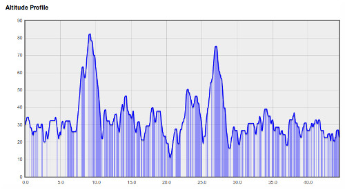
  • I've changed the altitude profile graphs (and thumbnails) so they no longer "zoom to fit". An example is the easiest way to show what I mean, this is what the altitude profile used to look like:

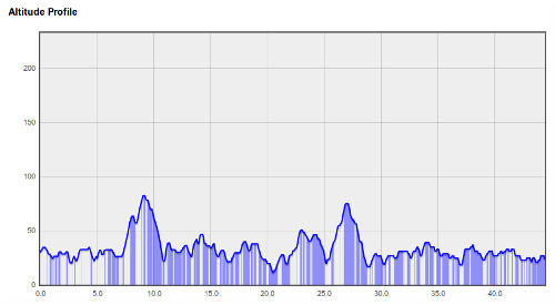
    Looks pretty steep and hilly, but the hills are only 50m high! The new graphs now limit the stretching so the profile is a bit more representative:

    The maximum exaggeration is limited to about 75 times, which seemed to offer a reasonable compromise that still shows the hills in some detail without ending up totally flat when the distances is very large.

  • Fixed a bug so tasks added to duration-based goals are correctly displayed in hours.

  • Fixed a bug so that activity details are displayed correctly if all points were removed by a filter.

Filed under  //  changelog   sharing   routes   sessions   tags   graphs  

Segmenting your activity using route checkpoints

Checkpoints are a powerful GPSLog Labsfeature for analysing your activity, they can:

  • Split activity into segments for comparison, without affecting the other statistics such as overall mileage and duration.
    This would not be the case if additional places were created as extra activity records would be created.
  • Compare your performance on a segment (such as a hill climb) for different routes.
  • Checkpoints are assigned on a route by route basis so they only cut the activity of interest.

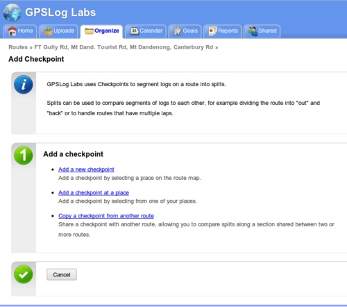
The easiest way to explain how checkpoints work is to run though a few examples: Once you've uploaded some activity to GPSLog Labs, you next need to assign a route to the activity. Once that's done, you can go to the Splits tab of the route detail page and click the Add Checkpoint link.

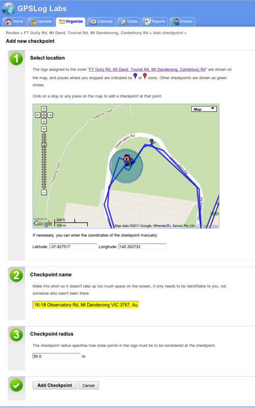
Then, create a new checkpoint by clicking on a point on the map or a stop on the log file.

Checkpoints work just like places. The activity inside the circle will be ignored, and the circle has to be big enough for all the logs to pass through it, otherwise they won't be recognised.

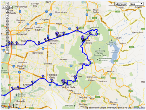
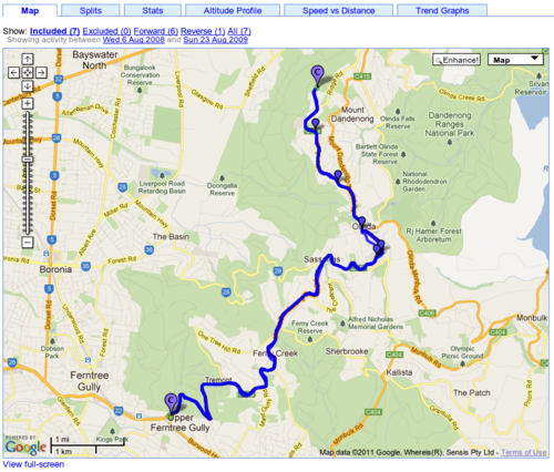
After saving checkpoints at the beginning and end of the climbs, the route map now looks like this:

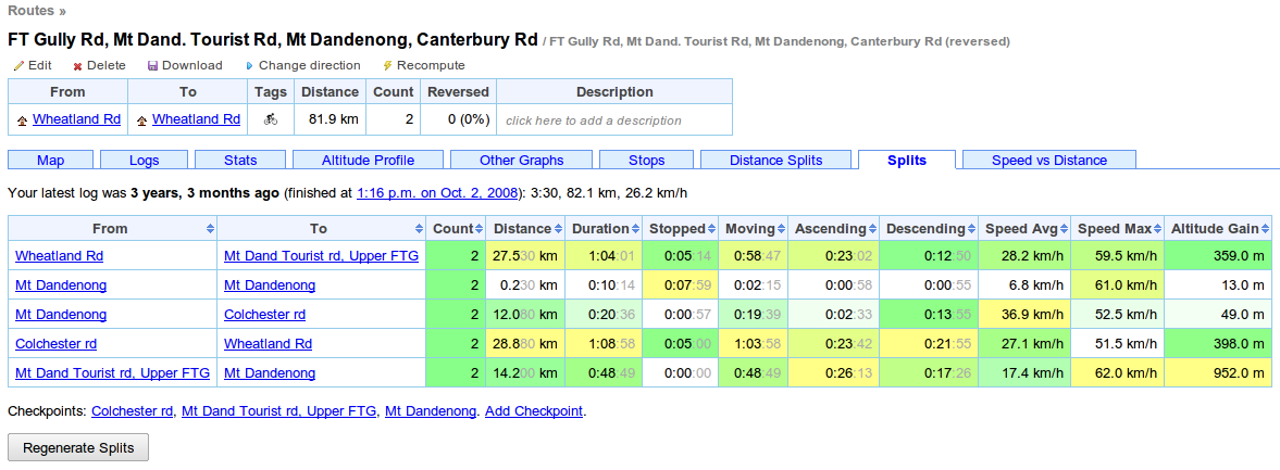
On the route detail Splits tab, a summary of the splits is displayed.

You may need to click the "Regenerate Splits" button, which will reprocess all the activity with the new checkpoints. This may take some time, so there's an equivalent button on the activity detail page's Splits tab that will reprocess only a single activity.

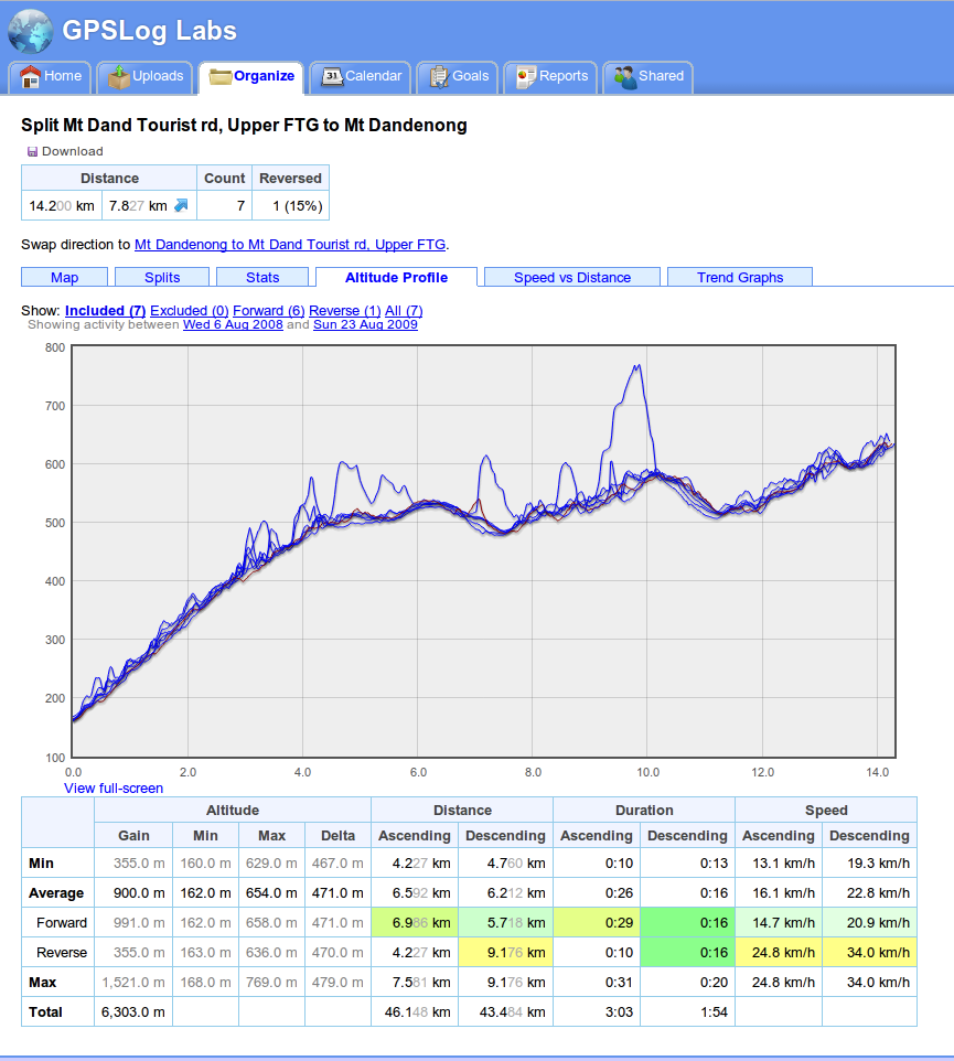
Clicking on the From or To checkpoint will bring up the split detail page. This page combines activity in both directions along the segment and lets you see maps, altitude profiles, trend graphs and other stats.

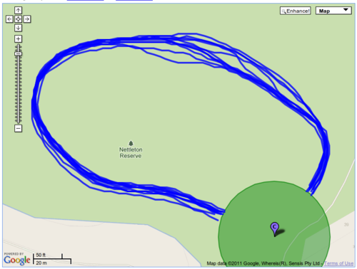
Checkpoints can be used to analyse short segments too, such as laps around an oval, or runs up and down a mountain (skiing or mountain biking, for example.)

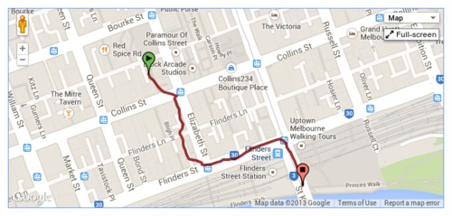
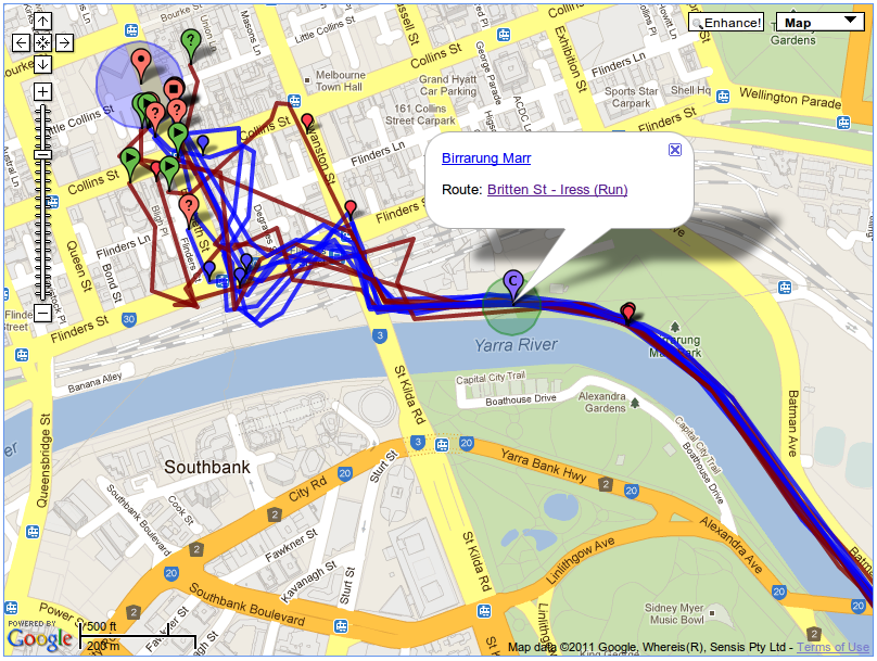
Another use is chopping off the ragged ends of a run, like in the following example where, when entering the city, the GPS signal becomes unreliable. By adding a checkpoint at the end of the path I can avoid the messy log file and also the disruption to my times caused by traffic lights and pedestrians.

This is a tricky area of the site to describe, but it's really useful, so have a play with it and if you have any questions, please let me know.

Filed under  //  checkpoints   documentation   routes   segments   splits  

Less tabs is more

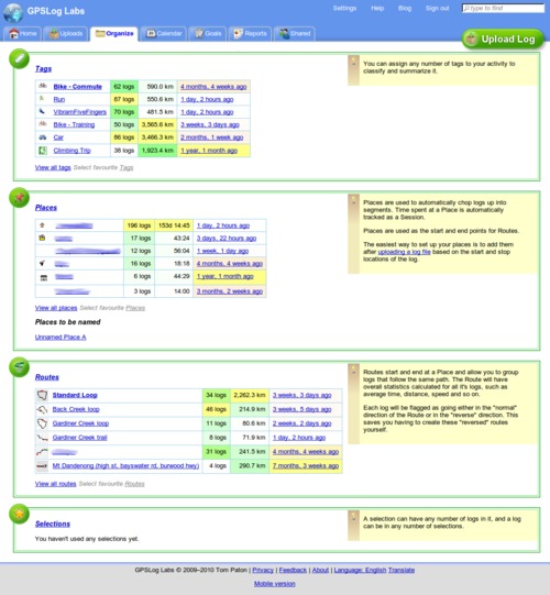
GPSLog Labs has a new "Organize" tab, this is a page that will show your most important and relevant tags, places, routes and selections for quick and easy access.

You can get to all of the information that was on the old Tags, Places, Routes and Selections tabs from the new tab so they've been removed.

The "importance" algorithm tries to weigh up the number of times the item has been used, the total distance and how recent the last activity was. This won't work perfectly, so you can choose to "pin" your favourite items to the top of the list for quick access.

Filed under  //  changelog   organize   places   routes   selections   tags  

Fancy route selection dialog

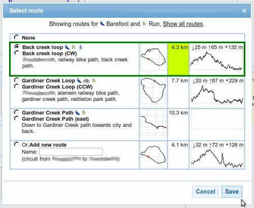
I've just updated the select route dialog when editing the processed activity for an uploaded log to make it nice and graphical, instead of an unclear dropdown list:

This will show the thumbnails for each route to help identify them, and also highlight in green the routes that are closest in length to the logged activity.

If you've assigned tags to the activity, the possible routes will be filtered. You can click the Show all routes link if you need to see other routes.

Filed under  //  changelog   routes  

Tag and route inference

GPSLog Labs has always made some basic attempts to automatically assign a route for a log segment if it can:

  • If there is a single route between the start and end places of the log it will be assigned automatically.
  • If there are no routes between the start and end places, one will be automatically created and assigned.

And now I've just added an experimental feature that will try to guess the route after you assign a tag. This is useful in those cases where you have 2 (or more) routes between places, say one by car and one by bike. The above automatic assignment won't work in these cases, but if you tell it whether it was by bike or car by tagging the route, it will look again for routes using only the assigned tags.

This works in reverse too, if you assign a route that always has a particular tag associated with it, then the tag will be automatically filled in too.

So, it'll vary depending on your setup, but you should be able to select the route in many cases and have the tags automatically assigned and select the tag in other cases to have the route automatically assigned.

Let me know if you come across any issues with this change, and hopefully it makes things a little easier.

Filed under  //  changelog   routes   tags   tips  
Older posts →

© 2013 Tom Paton | GPSLogLabs.com | Source | Feedback | RSS | Subscribe