GPSLog Labs Blog

GPSLog Labs Blog

New features and tips for using gpsloglabs.com

Filed under

places

Updates for September 26th

It's been a long time since I've updated the blog, but that doesn't mean nothing has been going on. Here are a few recent updates to GPSLog Labs:

  • Colour scheme update — hopefully this one is pretty obvious. Let me know if you find any remnants of the old colours or aspects of the new scheme that aren't working.

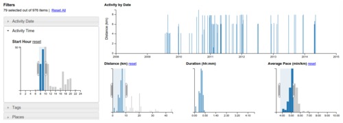
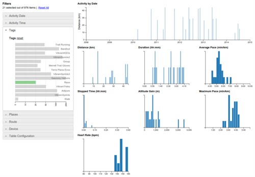
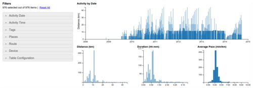
  • Tag crossfilter tab — This one is pretty neat. It uses the crossfilter library to provide an interactive exploration of the activity for a tag.

    You can click or drag a range of values on any of the charts and it will drill down and update all of the other charts and histograms immediately based on the new selection.

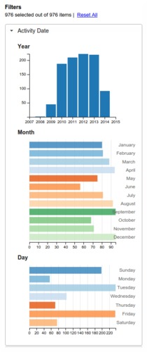
    Filters are available for many parameters, such as the date and time of the activity, the places and routes involved.

    This is a great way to answer a bunch of questions about your activity, such as:

    • when was the last time I ran route X faster than 5:00 min/km?
    • how many times have I run more than 30km?
    • what routes do I ride on weekends?

    The table at the bottom of the page shows the details of the selected activity and you can click through from there to the activity detail pages.

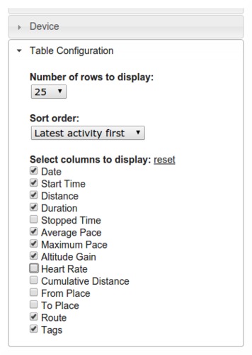
    The columns can be switched on and off too, which is handy if you've filtered in such a way that the places or routes are not interesting and just wasting space.

    There are still a few rough edges, so expect some improvements to this page as time goes on and it will be available in other areas of the site soon too.

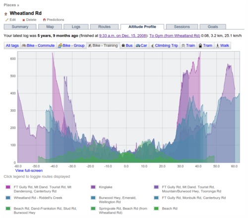
  • Place altitude profile tab — a semi-useful visualiation of the altitude profiles of routes to/from each place.

    The place is at the 0km point, incoming routes are to the left, outgoing to the right.

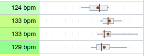
  • Added grid divisions to box whisker plots to help judge scale (15 sec increments for pace, 2.5 km/mile per hour for speed, 5 bpm for heart rate).

  • Changed goal tasks iCal file to output all day events. This is a bit less convenient in the calendar, but it avoids timezone problems.

  • The "At place" flag on a segment can be overridden if necessary. Click on the "At Place (x)" and click "Override and treat as a commute".

  • Fixed auto-detect timezone button and a bunch of other little bugs.
Filed under  //  changelog   crossfilter   graphs   places  

Updates for November 10th

Some recent updates to GPSLog Labs:

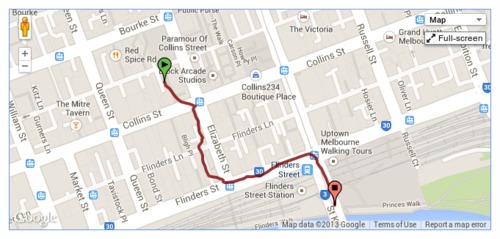
  • When filtering a log file using a time or position filter, you can now copy nearby waypoints, rather than drawing the line each time.

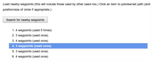
    Once you zoom into/select the area to be filtered, click the "Search for nearby waypoints" button.

    This will list all the nearby waypoints and you can click on them to copy them into your filter.

    This search uses not only waypoints you've created before, but also those created by all the other GPSLog Labs users, so you can take advantage of paths others have marked and save yourself some effort.

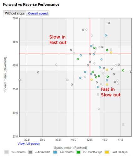
  • New forward vs reverse performance chart for routes.

    This graph compares the forward speed with the reverse speed for any days where you go in both directions on the route. E.g. a commute to and from work.

    The shading on the graph represents the 25th—75th percentile of the data, the red line indicates the median speed.

    Points in the bottom-right represent fast forward direction with a slow log in the reverse direction, while the points in the top-left are slow forward and fast reverse. (Note, this description is flipped for pace formats.)

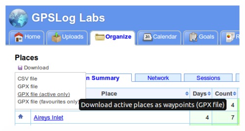
  • Download places as waypoints in a GPX file that you can load into your GPS to assist with navigation and route planning.

    The Places page has a new "Download" menu that lets you generate a GPX file containing waypoints for each of the places you have created.

    You can choose to get all your places, just the active places or just your favourites.

    This menu also incorporates the CSV download option which will get all your place information into a spreadsheet.

  • Downloaded zip files now have modified dates of the files set to the current date/time.

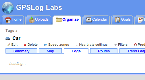
  • The tabs on various pages around the site now load dynamically, so you'll notice a little "Loading..." message after the tab is clicked. You can then quickly switch between the tabs without waiting for the whole page to load again. This is very handy when comparing the heart rate graph with the altitude profile or speed graphs, for example.

  • And lastly, a little tip:

    Set a place radius to 1m to prevent it being used to cut activity without having to mark it as inactive. This will still allow you to select the place as a start/end point manually.

    This can be handy if you pass by a place on a regular commute and don't want to have to remove the stop from your processed activity.

Filed under  //  changelog   routes   filters   position filter   time filter   places   waypoints   tips  

Updates for October 25th

Some recent updates to GPSLog Labs:

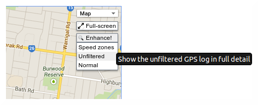
  • Speed zones can be displayed on maps.

    The "Enhance!" button on the maps has been converted into a dropdown menu, the old behaviour is now available from the "Unfiltered" option.

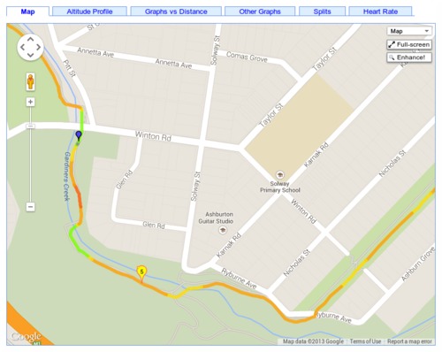
    The map on the activity detail page has a new option "Speed zones" which will colour the track on the map according to the speed zone.

    To enable this option, you'll need to configure speed zones for one or more of your tags.

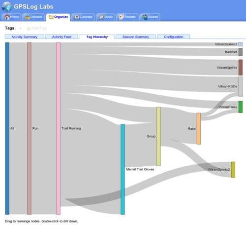
  • Tag hierarchy visualisation.

    This new tab on the Tags page will automatically determine the major tags you use (Ride, Run, ...) and minor tags within those (e.g. type of shoes, bike used, type of activity.)

    You can drag the tags around the graph to get a nice layout and double-click a tag to only include activity with that tag.

  • The place network visualisation now has options to sort the places according to time of first or last visit, as well as by name and count of visits.

  • You can once again edit activity notes directly from the log file activity editing page, rather than having to do it from the activity detail page.
Filed under  //  changelog   maps   tags   places  

Updates for December 22nd

  • The "This week's activity" table on the home page of GPSLog Labs now allows you to scroll back and forward through your uploaded activity using "« Previous|This week|Next »" links. The old "Earlier activity" link has been removed as it's no longer needed.
  • The Trends report has been optimized and now runs much faster.
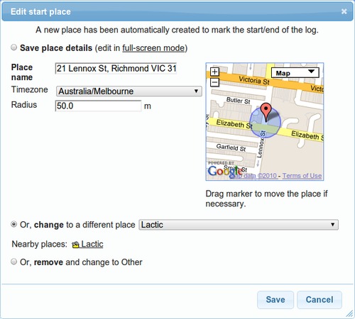
  • When editing an automatically created place, a list of suggested "Nearby places" is displayed to make it easier to correct logs where your logger didn't lock on at a place:
  • When editing an unmatched place, nearby places are now shown as markers on the map too. Clicking them will select the place from the drop-down list.
  • The activity detail page heading has been reformatted to make it easier to read:
    Screenshot-activity-detail-hea
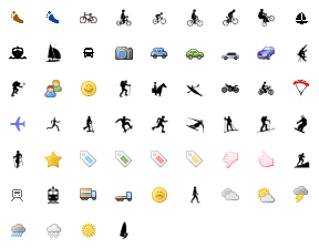
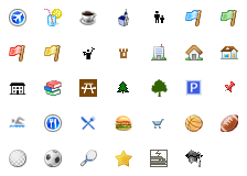
  • The libraries of icons you can select from for your tags and places have been expanded and refined. They should be better looking and more useful now. Edit your tags or places to change them to one of the new icons:

    Tag icons:

    All_tags

    Place icons:

    All_places

    You can still upload your own icons if you want to, for best results they should be 16x16 pixels, in GIF or PNG format with transparent backgrounds.

  • You can now add goals based on the built in training programs. Click the Add Goal from Training Program link on the Goals page, select the program, put in your goal finish date (race/event day), select the tag you'll use to track your training logs and you're ready to go.
  • Two new training programs have been added too:
  • Adding tasks to goals has been made faster and easier too, and a bug was fixed that was preventing adding fractions of kilometers as the target distances (i.e. you could only enter whole numbers, not 6.5km for example.)

As always, feedback and suggestions are welcome and I hope everyone has a happy and safe Christmas and New Year.

Filed under  //  changelog   goals   icons   places   programs   suggested places   tags   tasks  

Less tabs is more

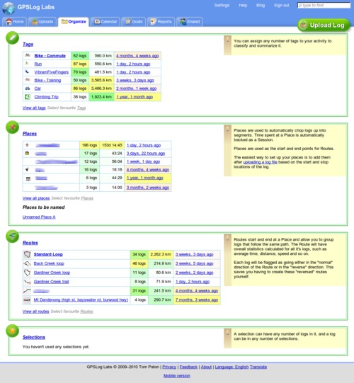
GPSLog Labs has a new "Organize" tab, this is a page that will show your most important and relevant tags, places, routes and selections for quick and easy access.

You can get to all of the information that was on the old Tags, Places, Routes and Selections tabs from the new tab so they've been removed.

The "importance" algorithm tries to weigh up the number of times the item has been used, the total distance and how recent the last activity was. This won't work perfectly, so you can choose to "pin" your favourite items to the top of the list for quick access.

Filed under  //  changelog   organize   places   routes   selections   tags  

Upload processing redesign

Well, the inbox redesign mentioned a few weeks back turned out to take longer than planned, but the end result is a huge improvement in the way you manage your log files with GPSLog Labs and the "inbox" doesn't really exist anymore.

I'll post a quick tutorial soon to show the basic steps involved in uploading a log and processing it, but for now, a summary of some of the major changes are as follows:

  • Activity is automatically extracted from uploaded log files and no longer needs to be "confirmed" before it shows up in the rest of the site.
  • You get much more direct control over the editing of the extracted activity.
  • Places will automatically be created based on your uploaded logs.

This last one is a biggy and results in a big change to the way you use GPSLog Labs. GPSLog Labs now "asks for forgiveness, not permission" and will create a new place whenever a log starts or stops in a location that can't be matched to an existing place. This means that you can get up and running with the site much more quickly.

When GPSLog Labs creates a place, you can either give it a name and keep it or if you don't want a place at that location, you can swap it for the correct place that should have matched.

Filed under  //  changelog   inbox   places   uploading  

Log Timezone Changes

I've just changed the way that GPSLog Labs detects the local timezone for a log to make it more reliable.

Each place now has a timezone field and this is used to set the default timezone for any logs to or from that place (kind of obvious really...)

When you're adding a new place, you can choose the timezone or just click the "Auto-detect" button which will use the geonames.org web-service to determine the timezone.

I have been able to fill in most timezones for places that have been created to date. Have a look at the Places configuration page though as you may have one or two that you'll need to set yourself.

If a log doesn't match any places it will default to the timezone you've set in your Profile page, and the timezone for a log can always be edited if you want it to be something different.

Filed under  //  changelog   inbox   places   timezone  

© 2013 Tom Paton | GPSLogLabs.com | Source | Feedback | RSS | Subscribe