Map controls
There are a couple of not so obvious features on the maps that GPSLog Labs uses.
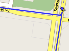
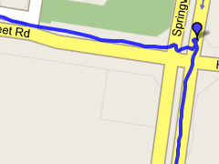
For speed reasons, the maps that are drawn have been "simplified", i.e. the number of points in the track has been reduced to speed up drawing and data transfer.
For most purposes, this will be fine, but if you want to zoom in and see the full detail of your track, there is a button on the map to "Enhance" the detail.
This will reload the page with the full log data mapped for the region displayed in the map. This means it's still pretty fast, but you can't pan too far or you'll need to click the enhance button again to reload more data.
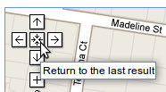
Additionally, on the built in pan tool is a "return to the last result" button. Clicking this will undo any zooming and panning you may have done and return the map to the original view when the page was loaded.
| ← Previous post | Next post → |


