Tip: Merging logs into a single Google Earth (KML) file
Here's something I've been playing with for a while that is now trivially easy using GPSLog labs: Merging GPS log files into a single KML file for viewing in Google Earth.
You can select a group of logs from any place where there is a tab of logs (a tag, a route, a date etc.):
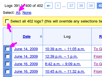
1. Click the "Select All" link on top of the table, then click the yellow "Select All" checkbox that slides out under that.
2. Choose Google Earth (KML), and select the following options (you must select Merged otherwise you will get a zip file containing the individual logs):
Simplify: This will reduce the number of points in the file by throwing away any points that are not necessary to define the shape of the tracks. i.e points along a straight line will be removed leaving only the end points.
Points: Output a small marker at each log point.
Lines: Output a line connecting log points.
Floating: If this is ticked, then the points will "float" above the ground according to their logged altitude reading. If it's not ticked, all logs will be "clamped" to the ground level.
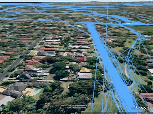
3. When you click Download Selected Logs you'll get a Google Earth file like the screenshot.
It's really cool to zoom in on a road you travel along a lot and see all the tracks woven together. You can also get some interesting variations by playing with the various KML generation options:
| ← Previous post | Next post → |


